British Library Makes 40,000 Historical Maps Available Online
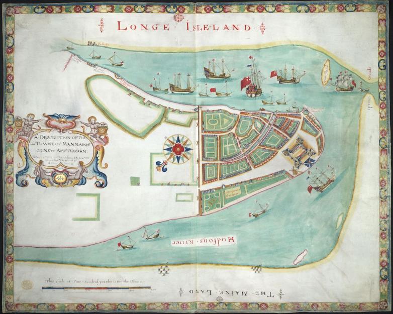
A hand-drawn map of New York City: A Description of the Towne of Mannados or New Amsterdam as it was in September 1661 lying in Latitude 40 de: and 40,: Anno Domini 1664.


A team of cataloguers, curators, conservators, and imaging specialists at the British Library (BL) has completed a seven-year project to digitize a collection of early maps from its Topographical Collection of King George III, aka “K. Top.”
The K. Top collection encompasses 300+ years, spanning 1500 to 1824, of printed and hand-drawn maps, architectural drawings, and more. The images are available via the BL's digital Flickr Commons collection to support “experimentation and reuse of the Library's data and digital collections in exciting and creative new ways,” according to the BL.
Highlights of newly digitized collection include a manuscript map of New York City presented to the future James II in 1664 (pictured above); the earliest comprehensive land-use map of London from 1800; and James Cook’s large manuscript map of the islands of St. Pierre and Miquelon, 1763.
Tom Harper, lead curator of antiquarian mapping at the BL, commented, “This is a momentous and intriguing set of early maps and views which provides multiple windows into the world of previous centuries. We’re pleased to have been able to make this outstanding collection available through cataloguing and digitisation and to enable aspects of Britain’s past to be more fully understood.”