Highlights of the Swann Galleries' Maps & Atlases, Natural History & Color Plate Books on June 11 include:
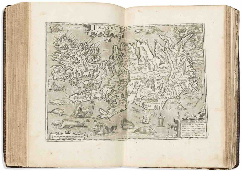
* Abraham Ortelius, Theatrum Orbis Terrarum, Antwerp, 1601
153 double-page maps, all engraved, well-worn contemporary tooled calf with gilt device of Jacobus Conrad Praetorius stamped to the upper cover and a Hieroglyphic Monad symbol to the rear, all edges gauphered and gilt.
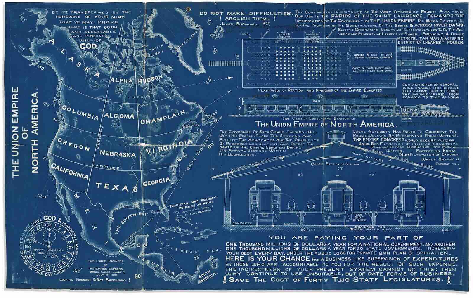
* The Union Empire of North America, The Empire Express, Union Empire, Chart 2, circa 1910
Large blueprint map and railway station broadside of a hypothetically merged Canada, United States, and Mexico. North America is shown curiously divided into Alaska, Alpha Hudson, Columbia, Algoma, Champlain, Oregon, Nebraska, Virgindia, California, Texas, Georgia, Mexico and Centralia, while the rail station plan and elevation designs are coupled with paragraphs promising industrial and economic success. The annotations and an accompanying handwritten letter to the Mayor of Pittsburgh (Virgindia) implore that figure to adopt proposals of the Union Empire by its acting governor James Buchanan.
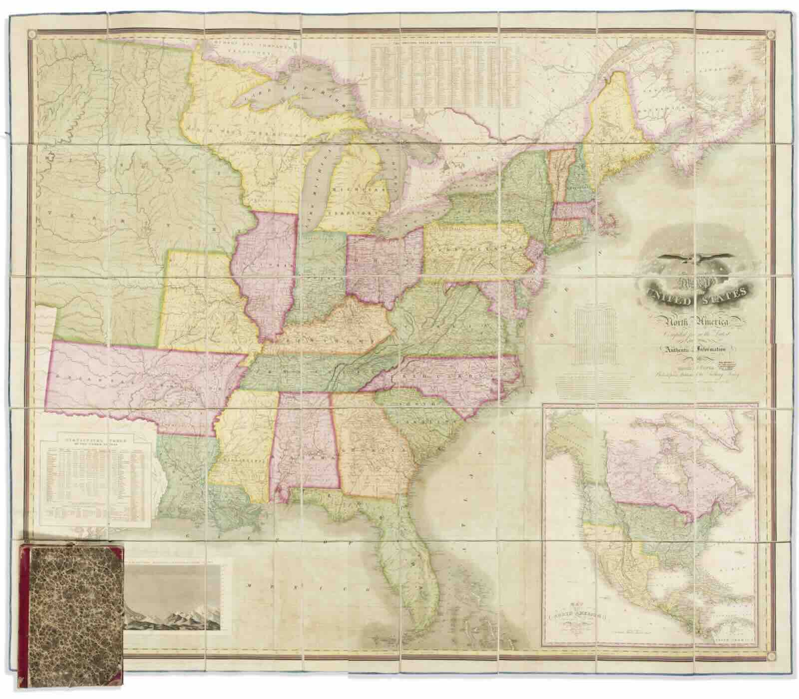
* Map of the United States of North America Compiled from the Latest and Most Authentic Information, David H. Vance and James Hamilton Young, engraver, Philadelphia, Anthony Finley, 1825
Engraved six-sheet wall map of the eastern United States with expansive Missouri, Northwest, and Arkansas Territories to the west; an inset of North America, a table of comparative mountain elevations, statistical tables, and a federal eagle haloed by 24 stars recognizing the number of states at the time balance the geography.