Rare Maps and Armillary Sphere Offered in Catawiki’s Exclusive Cartography Auction
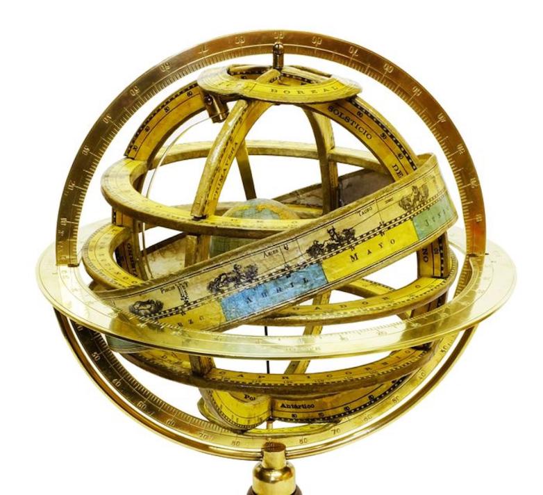
A Spanish armillary sphere manufactured at the turn of the twentieth century.


Amsterdam — Maps show the knowledge of the geography of a place at a given time, and Henricus Hondius’ America noviter delineata (1631) displays an unusual East Coast of North America, packed full of place names, including Chesdpiooc (Chesapeake), Sanawanook, Hatoraske (Hatteras); Charlefort, Cap de S. Roman, etc. The Great Lakes are not yet shown, nor does Long Island appear.
This beautiful and popular map of the Americas was emulated by numerous cartographers and went through various editions. Originally issued by Jodocus Hondius II in 1618 with carte-a-figures borders, it was derived from two earlier maps by Blaeu. North America retains the peninsular California and the East Coast is beginning to take shape, although it still lacks detail in the mid-Atlantic region. In the Southwest, the famous seven cities of Cibola appear on the banks of a large lake. In South America, there is a large inland sea on the equator and two engraved scenes -- one detailing a cannibalistic feast. Two stylized insets of the polar regions are enclosed in strapwork cartouches; the North Pole depicts Frobisher's theory of the Northwest Passage and the South Pole shows the long-held notion of the mythical southern continent. The map is richly ornamented with a strapwork title cartouche, fleets of ships and sea monsters.
Shortly after Jodocus Hondius' death in 1629 the plate passed into the hands of his brother, Henricus. The borders were removed to facilitate the smaller atlas. This is the third state with the imprint of Henrico Hondius and a date of 1631.
Marc Harrison, category manager Books, Manuscripts & Cartography at Catawiki: “One of The fascinations of maps, is our ability to see the development of knowledge over time. This beautiful map shows how knowledge of America grew in the early 17th century.”
The auction will be online starting Friday 21 August 2020 at 10:00 UTC | closing Friday 28 August 2020 at 18:01 UTC and will be visible at this link.
Other cartography sale highlights include:
-A very nice Spanish armillary sphere (pictured above). With a diameter of 20cm an height of 32cm, this would sit nicely on the desk of anyone who dreams of the planets. Paluzie manufactured these from 1885 to 1935, but this copy is a fairly early “model A” issued around the turn of the century. In excellent condition, it retains its original paper labels. https://www.catawiki.com/l/39616203
-A very nice copy of Klodt’s scarce Sterrenhimmel. This large map of the planets is over 1 metre tall by 1 metre wide. In excellent condition, it will be an unusual find for any collector of celestial objects. The chart rotates, allowing the observer to see the stars as the cross the skies. https://www.catawiki.com/l/39616035