Important Cartography, Audubon & More at Swann June 7


 New York—Swann Galleries’ June 7 auction of Maps & Atlases, Natural History & Color Plate Books offers nearly 400 groundbreaking maps, atlases, manuscript travelogues, naturalist plates and ephemera from every corner of the world.
Landmarks in the history of mapping the United States include the first representation of the country as an integrated landmass: John Melish’s Map of the United States with the Contiguous British & Spanish Possessions, 1816, with an estimate of $15,000 to $25,000. Also available is A Map of the State of Virginia Reduced from the Nine Sheet Map of the State, in Conformity to Law, 1827, by Herman Boye, the first official map of the state to delineate its geography with accuracy; it has not seen at auction since 1963 ($20,000 to $30,000). The first printed map of the Mississippi River based on first-hand exploration—the result of Louis Jolliet’s expedition to the region in 1673—carries an estimate of $15,000 to $20,000. Works by cartographical legends Lewis Evans, Henricus and Jodocus Hondius, Gerardus Mercator, Abraham Ortelius and John Reid will also be offered.
Another highlight is Nicolas de Fer’s L’Amerique Divisee Selon Letendue de ses Principales Parties, 1713, colloquially known as the “Original Beaver Map.” The large decorative wall map of the Americas was the first major map to include an engraved cartouche of a beaver in the wilderness, a motif emulated and popularized later by Herman Moll in in his World Described atlas ($10,000 to $15,000). The original carries an estimate of $20,000 to $30,000, and features California as an island on the west coast.
An engaging selection of maps of Manhattan that reveal the island’s shoreline before its development include an extremely rare hand-colored composite map of the city compiled in 1873 by Charles Kinnaird Graham for the Department of Docks, showing the original high and low watermarks around the southern tip of Manhattan overlaid with the projected development of piers, slips and bulkheads into the Hudson and East Rivers, estimated at $5,000 to $7,500. Also available is Egbert Viele’s “Water Map,” or Topographical Atlas of the City of New York, 1874 ($3,000 to $5,000).
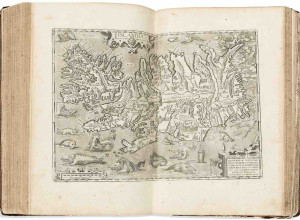
A fascinating variety of eighteenth- and nineteenth-century Japanese cartography will be offered. Highlights include a large folding manuscript watercolor map of the port city of Shimoda, 1858, one of the earliest cities to allow foreign diplomacy after Commodore Matthew Perry opened the island to trade with the west ($3,000 to $5,000). A contemporary archive of material relating to Perry’s 1853 visit, including a charming sketch of him, is valued between $2,500 and $3,500.
Highlights from John James Audubon’s Birds of America, 1830, include the hand-colored elephant plate of Fish Hawk, one of the most dramatic compositions in the canon, with an estimate of $30,000 to $50,000. Great Horned Owl, a hand-colored elephant sheet, leads a bevy of owl plates at $10,000 to $15,000. The first octavo edition of a complete subscriber’s copy of Birds of America, 1840-44, originally owned and compiled by John Pierce Brace, who devoted his life to the education of girls and women, will be offered at auction for the first time ($25,000 to $35,000).
Additional naturalist delights come in the form of the complete French edition of Johann Michael Seligmann’s Recueil de Divers Oiseaux, 1768-76, with hand-colored plates after Mark Catesby and George Edwards, at $15,000 to $25,000.
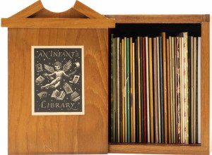
Entrancing watercolor albums from far-off lands include 19 circa-1920 scenes of Cuba by illustrator Edwin James Meeker, published in History of Cuba, by Willis Fletcher Johnson, with an estimate of $8,000 to $12,000. Following success with nautical travelogues, Swann will offer a book of 14 views of the Turkish coastline, presumably executed by a British serviceman as his ship passed through the Strait of Bosphorus on its way to the Crimean War ($2,500 to $3,5000).
The complete catalogue with bidding information is available at www.swanngalleries.com. Additional highlights can be found here.
Image: Lot 280: Map of Manhattan issued by the Department of Docks, compiled by chief engineer Charles K. Graham, 1873. Estimate $5,000 to $7,500.
Auction date: Thursday, June 7, at 1:30 pm EST
Exhibition dates: June 2, 12-5; June 4, 5 to 6, 10-6; June 7, 10-12