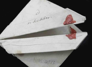
Christie's to Offer a Previously Unknown Copy of the Waldseemüller Gores


 London - On 13 December Christie’s Valuable Books and Manuscripts sale will offer a copy of the first map to name America by the most important cartographer of the early sixteenth century, Martin Waldseemüller. The appearance of this previously unknown copy of the Waldseemüller gores (estimate: £600,000 - 900,000 / $800,000 - 1,200,000), 1507, marks a significant cartographic discovery. This revolutionary map not only names America for the first time, but is also the first map to illustrate separate South and North American continents, and is the earliest recorded printed globe. It is one of only 5 known copies and is the first accurate illustration of the world in 360 degrees, depicting a separate Pacific Ocean. A large wall map, produced by Waldseemüller around the same time, and also naming America, survives in a single copy and was acquired by the Library of Congress in May 2003 for $10 million. The Waldseemüller gores will be on view to the public from 9 December, as part of Christie’s Classic Week.
Julian Wilson, Senior Specialist, Books, Maps & Manuscripts: “The discovery of this unknown copy of the Waldseemüller gores marks the most exciting moment of my twenty-year career at Christie’s, his cartographic innovations had an enormous influence in the science of map-making and perhaps most significantly, defined history in naming America.”
In 1505, the cartographer Martin Waldseemüller joined a group of scholars known as the Gymnasium Vosagense. The group was sponsored by René II, the Duke of Lorraine, and based at Saint-Dié-des-Vosges, south-west of Strasbourg. Waldseemüller was tasked with creating a new globe, a large world map and a new edition of Ptolemy’s Geographia and while doing so, broke away from standard cartographic conceptions to visualise Amerigo Vespucci’s claims that the North and South American continents might be separate from Asia. Boldly defining the Pacific and western coast of South America long before any European had officially seen it, Waldseemüller placed the name ‘America’ on the New World for the very first time.
Only four surviving Western maps earlier than Waldseemüller's depict the Americas in any form. The earliest is the Juan de La Cosa manuscript portolan chart, circa 1500, (Museo Naval, Madrid), followed by the manuscript Cantino planisphere (Biblioteca Estense, Modena) dated to 1502 and the 1504/1505 Caveri (Canerio) manuscript portolan chart (Bibliothèque nationale de France, Paris). Waldseemüller was influenced by the Spanish and Portuguese mapping of their new discoveries, as evidenced in these three maps, where the Gulf of Mexico, Florida, Cuba and other Caribbean islands are quite distinct, and the north coast of South America follows the earlier prototypes. By contrast, Waldseemüller's gores have little in common with the only earlier printed map to show the Americas: this is the world map of Giovanni Matteo Contarini-Francesco Rosselli (1506), which survives as a single copy at the British Library. It depicts Greenland and Newfoundland as an extension of Asia, is without a Central American coastline west of Cuba and illustrates South America as an unfinished northern coastline. Waldseemüller's radical advantage over the Contarini-Rosselli map lay in his taking into consideration the accounts of Amerigo Vespucci’s voyages to South America. A Florentine employed by the Medici bank at Seville, Vespucci met Columbus in about 1497-98, and was inspired himself to conduct exploratory voyages to the New World. His major voyage of discovery occurred in 1499 when he passed the Cape Verde Islands, and then sailed much further down the South American coast than previous Western navigators.
Vespucci realised that the South American continent was much more extensive than had previously been understood, and that it was not, as Columbus had initially thought, the eastern perimeter of Asia. Vespucci's announcement of this news in his Mundus Novus (Rome, circa 1502), with its vivid description of the New World, became a bestseller around Europe. Vespucci's influence was critical to the cartographic advances of Waldseemüller and in view of this and Columbus’ fading fortunes in the early 1500s, Waldseemüller named the continent ‘America’ in Vespucci’s honour.
Image: WALDSEEM?LLER, Martin (c.1470 - c.1522). World map in the form of a set of gores for a terrestrial globe. Saint-Dié-des-Vosges: 1507, estimate: £600,000 - 900,000 / $800,000 - 1,200,000