Miami International Map Fair Will Return to HistoryMiami, February 6-8


MIAMI (September 29, 2014)—The Miami International Map Fair, the longest continuously running map fair in the world, will return to HistoryMiami February 6-8, 2015. Visitors are invited to peruse and purchase antique maps from some of the finest map dealers in the world and discover the history and future trends of cartography.
“HistoryMiami is proud to host one of the largest and enduring map fairs in the world, highlighting an ever-growing admiration for international and rare maps,” Ramiro Ortiz, President/Chief Executive Officer for HistoryMiami. “Each year, the Map Fair showcases maps, lithographs and land plans that depict the world in a unique way, and gives collectors and map enthusiasts the opportunity to come together and peruse the items that are available at the fair.”
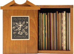
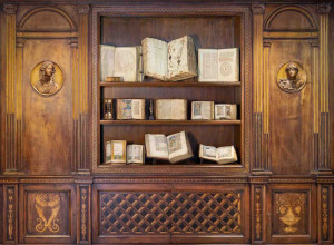
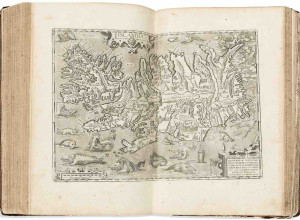
Held annually during the first weekend in February, the Miami International Map Fair provides both the serious collector and casual buyer with a weekend to browse antique maps, rare books, panoramas and atlases from around the world, as well as provide expert opinions and attend a series of special topical lectures. Visitors are also encouraged to bring in a map from their own collections for an expert opinion.
The 2015 lecturers include:
- Jacqueline V. Nolan - Cartographer and GIS specialist with the Library of Congress’ Geography and Map Division, Nolan has worked for several federal agencies including the Defense Mapping Agency, the National Park Service, and the U.S. Geological Survey, where she received recognition for her contribution in GIS on a national hydrologic regression model. Her maps have appeared in research journal publications, and in numerous reports issued by the Congressional Research Service.
- Richard H. Brown - A collector of maps, atlases and views relating to the French and Indian and Revolutionary Wars (1755-1783), Brown is involved with a number of public and private libraries, and maintains a particular interest in the conservation and digitization of rare maps. He is a Vice Chairman of the Norman Leventhal Map Center and currently chairs a committee responsible for a Revolutionary War exhibition. Brown is a councilor of the American Antiquarian Society and serves on the Madison Council of the Library of Congress and the Library Committee of the New York Historical Society.
- William B. Ginsberg - A published and acclaimed scholar, known for writing three major cartographic works: Sea Charts of Norway, 1585-1812 (2012), Maps and Mapping of Norway, 1602—1855 (2009), and Printed Maps of Scandinavia and the Arctic, 1482—1601 (2006).
Additionally, The Florida International University GIS Center has partnered with the Miami International Map Fair and will present interactive GIS presentations throughout the weekend.
Daily admission to the Map Fair is $20 for adults and children, $15 for HistoryMiami members and $10 for university students with ID. Weekend registration is $70 per person for HistoryMiami members and $80 for non-members and includes a VIP Private Preview, a cocktail reception with the map dealers, optional tours and complimentary lunch on Saturday and Sunday. Online Weekend Registration is open until February 3, 2015. Fair hours are Saturday, 10 a.m. to 5 p.m. and Sunday 12 to 5 p.m. at 101 West Flagler Street in downtown Miami. Parking is available at the Cultural Center Parking Garage, 50 NW 2 Avenue.
The Miami International Map Fair sponsors include Miami-Dade County and BrandsMart U.S.A. Sponsorship and underwriting opportunities are still available, please contact 305-375-1618 or email mapfair@historymiami.org for more information.
To register for the Miami International Map Fair or event information, please call 305-375-1618 or email mapfair@historymiami.org.
About HistoryMiami
HistoryMiami, a Smithsonian Institution affiliate, is the premier cultural institution committed to gathering, organizing, preserving and celebrating Miami’s history as the unique crossroads of the Americas. We accomplish this through exhibitions, city tours, education, research, collections and publications. Visit www.historymiami.org to learn more.
Image: Map of Guadeloupe (France), circa 1843. HistoryMiami, 2005-225-1.