Swann Galleries' December 8 Auction of Maps & Atlases


New York— On Tuesday, December 8, Swann Galleries will offer The Mapping of America: 85 Important Maps & Atlases alongside the auction of Maps & Atlases, Natural History & Color Plate Books.
The auction begins with a separate catalogue dedicated to an 85-lot offering of premium maps: a tour through the mapping of North America, beginning with early European conceptions of the continent and following the expansion of the nation all the way through the settling of the Wild West. The tour begins with lot 1, Sebastian Muenster’s Tavola dell’isole nuove, Basel, 1558, the earliest map to depict the entirety of America and name the Pacific Ocean (estimate $3,000 to $5,000). Some of these early maps seem barely recognizable to modern eyes and contain famous errors, such as the long-lasting cartographic fallacy of mapping California as an island. One example in the sale predates the famed Brigg’s map thought to be the earliest representation of California as an island, a map inset in the title page to Johann Theodor de Bry and Michiel Colijn’s Zwolffter Theil der Newen Welt, Frankfurt, 1623 ($1,000 to $1,500).
In the maps that follow, the continent gains detail and recognizable shape as territory is fought over and explored during westward expansion. We see territorial changes in Robert Sayer’s A New Map of North America, a large engraved folding map which included relevant articles of the Treaty of Paris of 1763, extending the boundaries of English colonies west of the Mississippi, London, [1763] ($1,500 to $2,500); and a first edition of Lewis and Clark’s History of the Expedition under the Command of Captains Lewis and Clark, in two volumes with a large engraved folding map, New York, 1814 ($60,000 to $90,000). The second edition of Heap and Ludlow’s map of the Dakota Territory, published 1875, features manuscript additions in an unknown hand, detailing the founding of Deadwood, Spearfish and Rapid City ($10,000 to $15,000). This will be the map’s first known appearance at auction.

The pièce de résistance in the “Mapping of America” section is William Faden’s The North American Atlas, with 42 engraved maps. According to Seymour Schwartz and Ralph E. Ehrenberg, this rare volume, published in London circa 1780, is the most important atlas dealing with the events of the American Revolution, including detailed regional maps and battle plans drawn by eyewitness observers. Like all copies of Faden’s Atlas, this example was made to order, with individual buyers choosing additional maps to augment a core set. While the commissioner of this piece remains unknown, the additional maps selected belie a keen interest in military matters; most notable is the inclusion of Bernard Ratzer’s Plan of the City of New York. The atlas is estimated at $300,000 to $500,000.
The sale continues in the afternoon with sets of engraved plates extracted from the first edition of Mark Catesby’s The Natural History of Carolina, London, 1731-46, including a group of 31 hand-colored engraved plates ($12,000 to $18,000) featuring various flora and fauna native to the region. Also featured are Sir William Hamilton’s Collection of Etruscan, Greek, and Roman Antiquities from the Cabinet of the Honble. Wm. Hamilton, 390 numbered etchings and engravings in three volumes (of four) recording Hamilton’s collection of vases, published in Naples, 1766-76 ($10,000 to $15,000); and several beautifully-crafted globes including Johann Gabriel Doppelmayr’s, Globus Terrestris and Globus Coelestis Novis, a pair of German 8-inch table globes each composed of 12 engraved gores, Nuremberg, 1739 and 1750 respectively ($15,000 to $25,000).
The auction will be split into two sessions on Tuesday, December 8, beginning at 10:30 a.m. and resuming 12:30 p.m. The auction preview will be open to the public, with an exhibition opening Thursday, December 3 and Friday, December 4 from 10 p.m. to 6 p.m., Saturday, December 5 from noon to 5 p.m.; and Monday, December 7 from 10 a.m. to 6 p.m.
An illustrated auction catalogue is available for $35 from Swann Galleries, Inc., 104 East 25th Street, New York, NY 10010, or online at www.swanngalleries.com.
For further information and to make advance arrangements to bid by telephone during the auction, please contact Alex Clausen at 212-254-4710, extension 17, or via e-mail at aclausen@swanngalleries.com.
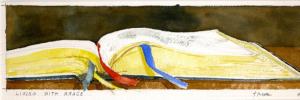
First image: Lot 79. Lewis & Clark, History of the Expedition, first edition, with the cornerstone Map of Lewis and Clark's Track, two volumes, Philadelphia, 1814. Estimate $60,000 to $90,000.
Second image: Lot 58. William Faden, The North American Atlas, with 42 engraved maps, including Ratzer's Plan of the City of New York, London, 1777 [circa 1780]. Estimate $300,000 to $500,000. Called "The rarest and most important atlast treating events of the American Revolution" by Schwartz & Ehrenberg.