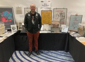
Preservation of Historic Map


The Charlestown NH Historical Society recently used a creative approach to secure funding for the conservation treatment of an 1860 map of Sullivan County, New Hampshire. Printed on paper, coated with varnish, and attached to a decaying cloth backing, the large map was made to hang on a wall from wooden supports. The map was beginning to crumble and was in dire need of conservation treatment to preserve it for future generations.
The topographical map was published by Smith and Morley in 1860 from surveys by H. F. Walling, the renowned cartographer. It details roads, rivers, churches, doctor’s offices, stores, and homes with each owner’s name listed. Town centers are shown in separate, detailed insets. Maps from this time period provide a vivid snapshot of the community and its residents, and are an important resource for historical researchers and genealogists.
“Whenever we showed people the map, they immediately wanted to see who lived in their house in 1860,” explains Joyce Higgins, Charlestown Historical Society President, “but we couldn’t keep rolling and unrolling it in the condition it was in. It was just too fragile.”
Charlestown Historical Society Treasurer Eric Lutz applied for a grant from the Claremont Savings Bank Foundation in Claremont, NH. ”I gave them the information and explained that we had treated two other maps with funding from the society but we didn’t have enough to do a third one,” Mr. Lutz said. The Savings Bank Foundation awarded a grant of $750 for the map project. The historical society applied to the Connecticut River Bank as well, and received a second grant of $500.
The Society did a great job publicizing the grants, and after the story appeared in local newspapers the Harvey & Christina Hill Foundation, a local charitable trust, donated another $500 toward the map's treatment. Other private funders saw the newspaper articles and covered the remaining costs.
The map was sent to the Northeast Document Conservation Center’s facility in Andover, Massachusetts, for treatment. The yellowed varnish was removed using ethanol and the map was washed to clean the paper and reduce acidity. The decaying cloth backing was removed before the map was lined with Japanese paper. After being mounted on linen for additional support, the map was encapsulated in transparent polyester film (Melinex®) to protect against dirt, handling, and atmospheric pollution.
The community will celebrate the return of the 1860 map of Sullivan County when it is displayed in turns at both the Claremont Savings Bank and the Connecticut River Bank during the coming months.